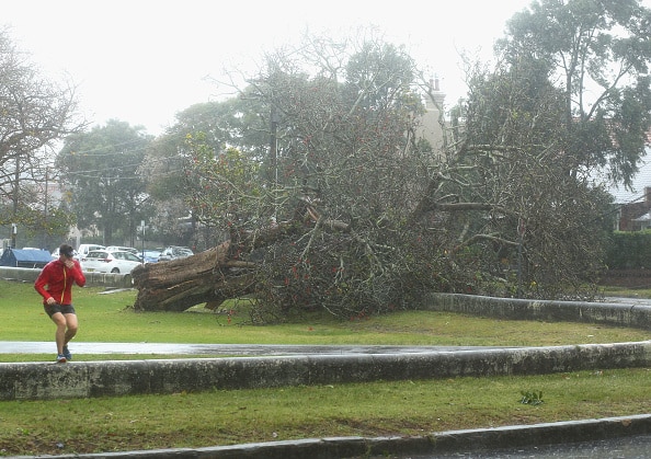
Cold fronts and low-pressure systems are continuing to bring wintery conditions to much of south-eastern Australia this week and possible alpine snow, with showers, storms, strong and gusty winds and well below average temperatures for this time of year.
For large parts of inland New South Wales, eastern Victoria and the ACT, the first half of December is looking to be one of the coldest on record – for both maximums and minimums – despite warmer conditions over the weekend.
Some of the highest rainfalls in the 24 hours to 9am include:
• 74 mm at Perisher Valley, NSW
• 58 mm at Thredbo,NSW
• 53 mm at Toomadam, NSW
Some of the strongest winds gusts in the 24 hours to 9am include:
• 115 km/h at Thredbo, NSW
• 102 km/h and 42mm at Mount Hotham, Vic
• 98 km/h at White Cliffs, NSW
• 91 km/h at Moss Vale, NSW
Severe thunderstorms are likely today across parts of New South Wales and Queensland with large hail, damaging winds and heavy rainfall that may lead to flash flooding.
Severe thunderstorm warnings are current across parts of New South Wales for damaging winds, while a severe weather warning for damaging winds is also current for parts of eastern New South Wales.
Snow flurries are possible for New South Wales’ highest alpine peaks on Monday, while on Tuesday into Wednesday snowfall is possible above 1200/1300m in Victoria and New South Wales, and above 1000m in Tasmania.
Maximum temperatures will be 6 to 12 degrees below average for much of south-east and southern Australia this week with Hobart and Melbourne also potentially experiencing record-low maximum temperatures this week.
Meanwhile, across Northern Australia heatwave conditions are easing with humidity and storms returning.
Severe to extreme heatwave conditions have impacted many northern Australian communities over the past week with temperatures in the mid to high 40s at many locations.
Heatwave Warnings are current for parts of Western Australia, Northern Territory and Queensland; however, these conditions will begin to ease today and tomorrow. They will further ease from Tuesday, bringing showers and thunderstorms across northern Western Australia, Northern Territory and northern Queensland.
Northern Territory Health has issued an Emergency Warning for high temperatures affecting communities around Darwin, Katherine, Nhulunbuy, and surrounding areas.
Maximum temperatures are expected to reach the low to mid 40s today across parts of northern Western Australia, Northern Territory and western Queensland. Some locations in the Pilbara may exceed 45 degrees.
Showers and thunderstorms will return to the Kimberley, Top End and northern Queensland in the coming days and may produce gusty winds and locally heavy falls.
Some parts of the northern tropical coast of Queensland will reach locally severe heatwave conditions from mid-week.
Extreme fire dangers are forecast for parts of Western Australia in the coming days.
A Flood Watch is current for parts of northeast Victoria and south-east New South Wales, with a risk of minor flooding in north-east Victoria and south-east New South Wales over the coming days.
Residents and communities living on or near any rivers, creeks, and streams or in low lying areas are advised to stay up to date with the latest forecast and warnings.
For all the latest Warnings see National Warnings Summary.
Know your weather, know your risk. Communities should stay up to date with the latest forecasts and warnings via the BOM website and BOM Weather app and follow advice of emergency services.


