Queensland’s far north is bracing for the likely arrival of Tropical Cyclone Jasper on Wednesday.
Residents between Cape Melville, on the eastern coast of Cape York Peninsula, and Townsville have been placed on notice that destructive winds and potential flooding are headed their way.
They’ve been warned trees and powerlines are likely to be felled and roofs blown from houses along with anything not tied down.
Should Jasper remain on its current trajectory, power, phones and internet services are expected to be lost and water supplies interrupted, Queensland Fire and Emergency said on Sunday.
Storm surges would also mean flooding in some places and communities isolated.
Before announcing her shock retirement from politics on Sunday, Premier Annastacia Palaszczuk said she had been briefed on the category 2 cyclone.
“I can say that all preparations are well and truly in place,” she told reporters in Brisbane.
“It is expected to make land on Wednesday and can I just remind Queenslanders and especially North Queensland to take care.”
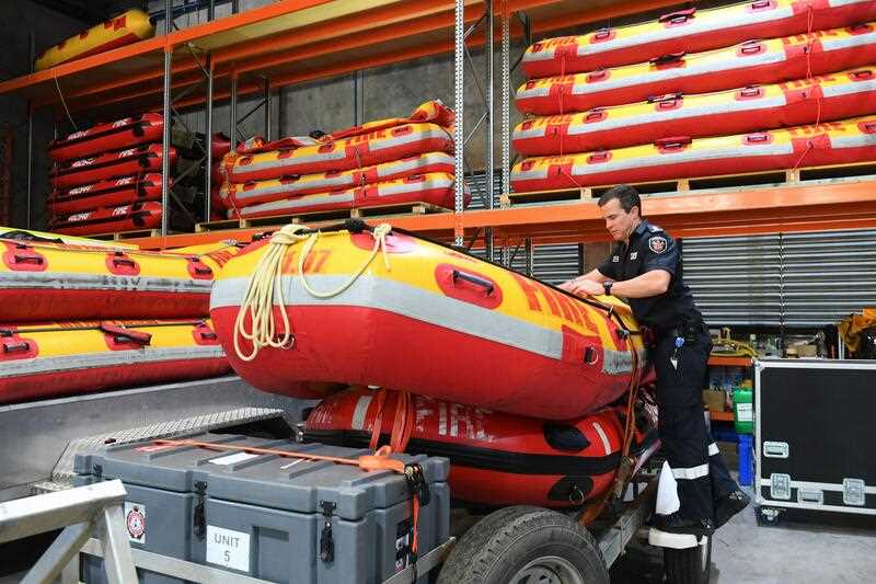
Specialist began preparing swift water rescue craft ready to be shipped north, at a facility in Brisbane on Friday.
At 12pm on Sunday, Jasper was some 450km east of Willis Island, 900km east of Cairns and tracking southwest at 13km/h.
The Bureau of Meteorology says the system may re-intensify to category 3 before crossing the coast somewhere between Cape Melville and Cardwell.
Meteorologist Jonathan How warned gale force winds of up to 90 kilometres an hour could hit within the next 48 hours, particularly along the coastline south of Townsville.
Daily rainfall totals are predicted to be excess of 200 millimetres in some areas, he said.
A severe weather warning has been expanded south to Mackay with possible damaging wind gusts expected on Monday.
Both Cairns and Cooktown lie within what BoM is referring to as the area of highest risk.
A rescue helicopter safely evacuated four bureau scientists from a remote weather station on Willis Is on Saturday.
“Wherever Jasper crosses it will be a significant event likely to bring damaging to destructive winds, heavy persistent rain that will lead to flooding, a storm surge along the coast and very dangerous conditions out over the water,” senior meteorologist Angus Hines said.
Queensland Police Acting Deputy Commissioner Shane Chelepy warned households north of Mackay to prepare their emergency kits.
The state disaster centre has moved to alert level, with local and district co-ordinators from Mackay to Cairns making preparations.


