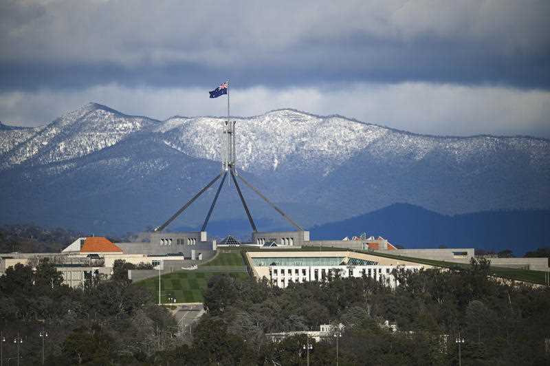
Much of southern and eastern Australia will be impacted by a powerful cold front and associated low pressure system from Sunday and into next week, the Bureau of Meteorology warns.
Communities in Western Australia, south-east South Australia, Victoria, Tasmania, eastern New South Wales and the ACT will likely be impacted by these weather systems.
The main effects will be a rapid transition into a wintry weather pattern just in time for 1 June, with below-average temperatures, showers, low-level snow and brisk winds.
Some communities will experience the coldest temperatures of the year so far.
For the ACT and NSW, the cold front is set to bring a burst of wintry weather on Monday and Tuesday with cold strong to gale force winds. A Severe Weather Warning may be issued, the Bureau suggests.
The cold front may bring significant rainfall to NSW’s southern inland, mainly around western parts of the central and southern ranges.
Snow is expected in the Alpine region, with a chance of snow around higher parts of the ranges outside of the Alpine region extending as far north as the NSW Central Tablelands.
Some parts of the NSW coast could see very high winds particularly late on Monday and into Tuesday.
Flooding is continuing in several central inland and northern inland NSW river systems from water flowing downstream from Queensland. Flows in these catchments are generally very slow, and flood peaks will take considerable time to ease. The Bureau encourages the NSW community to check road and river conditions regularly.
Western Australia
The first impacts of the cold front will be felt across southern WA from Saturday with most showers confined to the south of Perth.
Showers, gusty winds and thunderstorms are possible around the South Coast during Saturday, extending to the Eucla district during Sunday.
Severe weather will also occur across north-west WA, with another pulse of tropical showers and storms moving down from the Indian Ocean over the Pilbara District.
The ground is moderately wet from recent rains; a Flood Watch has been issued for the Pilbara Coastal Rivers, for potential flooding from Saturday.
Heavy rainfall is forecast over Pilbara Coast from Saturday. Rainfall totals of 30 – 60 mm with isolated falls up to 80 mm are forecast over the Flood Watch area for Saturday. Further rainfall totals of 50 – 90 mm with isolated totals up to 120 mm are possible on Sunday.
Flooding of low-lying areas and river rises are expected. Many roads, and possibly primary and secondary highways, may be affected. Some communities may become isolated. Check road conditions before travelling.
South Australia
The cold front will move through western SA from Sunday morning, extending to SA central districts into the afternoon and evening.
Showers will intensify, extending from the west, with possible gusty thunderstorms and heavy showers which may extend over agricultural areas to the Northeast Pastoral district on Monday.
A Severe Weather Warning may be issued for damaging wind gusts.
Elevated seas and large waves are possible in the west on Sunday and moving into central coasts on Monday.
Temperatures will likely to be the coldest or nearly the coldest day of the year so far for many locations.
Victoria
The powerful cold front will cross the state on Monday/Tuesday, with gusty showers, strong winds, and possible storms, as well as possible blizzards around alpine peaks on Tuesday.
Severe Thunderstorm and Severe Weather Warnings for damaging winds may be issued, with Gale Marine Warnings and Sheep Graziers Warnings likely.
Cold air thunderstorms are a risk across large parts of the state on Tuesday, with small hail possible.
Snow level expected to lower to 1200 metres on Monday, then to near 700 metres on Tuesday.
Tasmania
The cold front may bring strong southerly potentially damaging winds, a drop in temperatures and snow to as low as 700 metres Tuesday evening and Wednesday morning.
Small hail and cold weather thunderstorms (mainly over maritime areas) are possible.
The Bureau is recommending communities stay up to date with the latest Bureau warnings through the Bureau’s website and BOM Weather app and follow the advice of emergency services.


