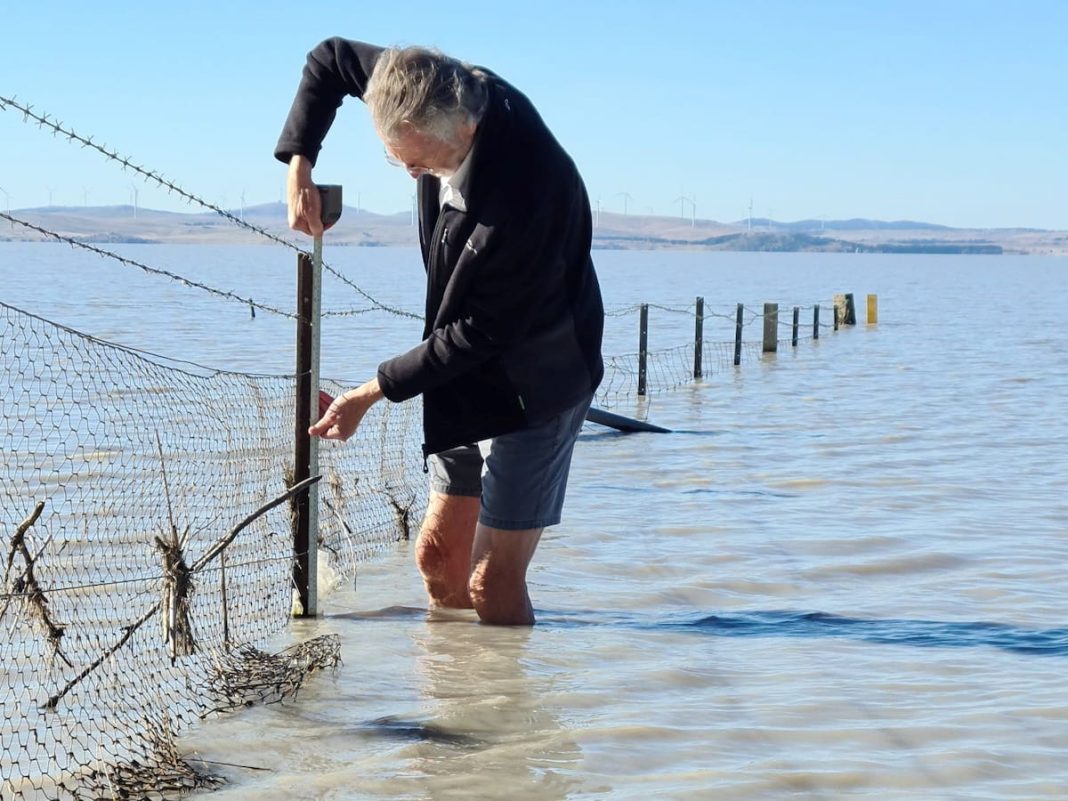
As winter solstice approaches and daredevils prepare to skinny dip in Lake Burley Griffin, there’s one Canberran who wades into frigid waters every fortnight without fanfare.
Retired geology professor, 71-year-old Brad Pillans, wades out barefoot (not bare bum) into Lake George every fortnight to measure water levels in often freezing waters.
The dedicated professor from the ANU’s School of Earth Sciences, does this all in the name of science, all year round, to maintain a record of water levels that has been continuous since 1820.
“I can report that the water is very cold already,” Brad said, wearing shorts on a 12-degree day near the shores of Lake George. “It feels much colder when I was up to my upper thighs.”
As most Canberrans would notice on their way to Sydney along the Federal Highway, sometimes the lake’s there, sometimes it’s not. This is precisely why Brad studies Lake George so intently, to understand how the unreliable lake responds to varying rain events.
“At this time of year the water level doesn’t drop a lot because there’s not much evaporation,” he said. “If we get reasonable rain this winter, we’ll have a full lake right through this year. It’s unusual because we haven’t seen three years of a full lake since the mid-90s.”
As for skinny dipping in Lake Burley Griffin, Brad said he’d already done a nudie swim in the Antarctic in the ‘80s, which is enough.
“When I was in Antarctica in 1984, I swam in Lake Vanda in the polar ice and I’ve even got a badge to prove it – a member of the Royal Lake Vanda Swim Club,” Brad said. “The lake’s near a remote NZ research outpost called Scott Base, it is the most southerly lake in the world. So, I have done skinny dipping in freezing cold water years ago but I don’t have any need to do it anymore except for the purpose of my research on Lake George. I’ll leave it to others to do that.”
If you’re wondering why there isn’t some sort of technology to calculate water levels instead of barefoot Brad and his tape measure, there is.
There used to be an automatic measuring device – until it broke. Then ANU PhD student Michael Short, who was collecting the measurements, finished up so it fell to (semi-retired) Brad, who uses an old fence line jutting into the water to take measurements.
“Michael developed a means of measuring water level using satellite imagery but it’s not as accurate as measuring it directly with a tape measure,” Brad said. “From satellite images you can measure water levels to plus or minus 15cm, whereas I can do it to the nearest centimetre.”
Officially, Brad is retired. However, he’s never missed a measurement since he started taking manual recordings in 2022.
“When I finally hang up my tape measure, it’s pretty much citizen science. If there is someone who’s interested enough, they could do it. If someone who’d like to take it on after I’ve had enough, I’d love them to do it.”


