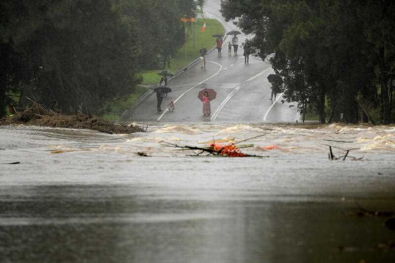
NSW residents are being warned the current bout of wet weather hitting the east coast is only going to get worse, with more rain, powerful winds and surging seas on the way.
Two Australian Defence Force helicopters will be available to assist with rescues as areas of the state brace for intense rainfall and possible flooding.
Three flood rescues have already been performed since Friday, with people along parts of the Hawkesbury River being warned they face a major flood risk.
NSW Emergency Minister Steph Cooke said flash flooding could occur anywhere from Newcastle to Jervis Bay.
“We are all waiting nervously to see what eventuates,” she said on Saturday, adding she remained confident emergency services were prepared for what was coming.
The Bureau of Meteorology’s Jane Golding said there would be a “deterioration” of weather overnight, with a risk of flash flooding and landslips.
“The rainfall rates will increase,” she said.
“We’ll start to see the wind increase as well. We’ll see the seas whipped up and we’ll see the rivers respond to the rain that’s falling.”
The federal government approved ADF support at the request of NSW on Friday night, with 100 troops available from Sunday onwards, Emergency Management Minister Murray Watt said.
There is a risk of severe flooding around Sydney and the Illawarra, as well as the Hawkesbury and Nepean regions from Sunday through to next week.
“I want to assure people that the federal government … is 100 per cent prepared for what might lie ahead,” Senator Watt said from Brisbane on Saturday.
“One of the things that we’ve learned over the last couple of years is that when we don’t have a federal government that takes responsibility and isn’t proactive, bad things can happen.”
More than 200 millimetres of rain fell south of Wollongong overnight, and there are warnings for six-hour totals of between 80 and 150 millimetres in Sydney and the Illawarra.
The weather system comes on the first weekend of school holidays in the state, and drivers are being urged to take extreme caution.
“We know floodwater is extremely dangerous, especially for drivers. If the road is flooded, turn around and find another way,” Transport for NSW’s Roger Weeks said.
Routes in and out of Sydney are likely to have congestion, with heavy traffic expected at known pinch-points, particularly around the airport.
Hazardous surf and swell conditions are also expected.
The Bureau of Meteorology said the system may develop on Sunday or Monday, prolonging the persistent rain into next week.
Flooding is possible for the Hunter, Central Coast, the Greater Sydney region and the South Coast from Saturday, with flood watches in place for catchments between Newcastle and Batemans Bay, including Sydney and the Illawarra.
Areas at risk include Newcastle, the Central Coast, Lake Macquarie, the Upper Coxs, Colo, Macdonald, Woronora, Patterson, Williams and Lower Hunter rivers.
Also at risk are the Upper and Lower Nepean and Hawkesbury rivers.
By Nick Gibbs, Phoebe Loomes and Finbar O’Mallon in Sydney


